Here comes our latest surprise at Hey Iceland! A selection of hiking trails around Iceland to satisfy the outdoor enthusiast in you! Spread over the country, our selection of hikes are short, duration varying from 0.5 to 4.5 hours, with moderate levels of difficulty - from Easy to Medium.They have the great advantage of being located in the vicinity of our accommodation partners. We at Iceland are delighted to sponsor these trails on the Wapp walking app (available on Google Play and in the Apple Store), which allows you to:
- Check the detailed itinerary and prepare accordingly
- Download the hiking route for free on all your devices and get real-time GPS assistance
- Learn interesting facts along the way and read about legends that have arisen from the place
- Warn the 112 service of your departure for safety reasons
- Browse more trails nearby!
This week, we invite you to check 5 trails in the Northern region! Happy hiking!
KOLUGLJÚFUR
- Location: Kolugljúfur
- GPS Coordinates: 65.332775,-20.570097
- Region: North
- Duration: 0,5 hour
- Difficulty: Medium
- Distance: 1417m
- Height: 185m
- Increase: 10m

Photo Source: Visit North Iceland
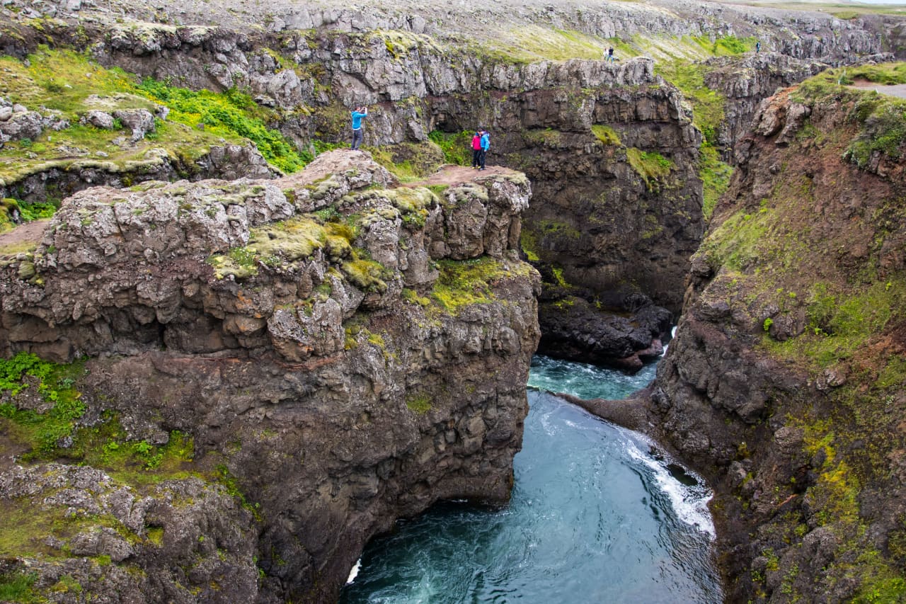
In Víðidalur valley in Víðidalsá river, there is a beautiful canyon called Kolugljúfur. It is just under 2 km long and 20-30 m deep. The legend says that the giantess Kola digged the canyon and used it as her dwelling place, using Kolúrum on the western side of the canyon as her bed. It's easy to walk along the canyon and impressive to look at the beautiful scenery, floods and waterfalls. The walk is suitable for most people, but be careful not to go too near the edges of the cliffs.
Accommodation nearby: Dæli Bed&Breakfast - Stóra-Ásgeirsá Farm Stay - Neðra-Vatnshorn Farm Stay
MÆLIFELLSHNJÚKUR
- Location: Mælifellshnjúkur
- GPS Coordinates: 65.390327,-19.352975
- Region: North
- Duration: 3,5 hours
- Difficulty: Medium
- Distance: 7277m
- Height: 462m
- Increase: 713m
This is the tallest mountain on the west side of Skagafjörður, an area most often called "West of the waters", as the glacial rivers used to split in two halves, before bridges were built. Mt. Mælifellshnjúkur is magnificent seen from the North and from there it looks pyramid shaped, but seen from the East it's clearly visible that it is in fact a mountain ridge. The hike up the mountain is not as difficult as one would think, as it is very passable in good weather. Take note that the weather may change swiftly, be well dressed and bring food. The view to all directions is amazing on a clear day. You set off from Mælifellsdalur, the elevation is pretty gradual and the trail reasonably good and posted. This trail can be recommended for those who for example feel comfortable hiking up to Steinn in Mt. Esja.
Accommodation nearby: Sölvanes Guesthouse - Syðra Skörðugil Guesthouse
STAÐARBYGGÐAFJALL
- Location: Staðarbyggðafjall
- GPS Coordinates: 65.5946780,-18.0084
- Region: North
- Duration: 3,5 hours
- Difficulty: Medium
- Distance: 9402m
- Height: 236m
- Increase: 776m
The hike up Mt. Staðarbyggðafjall is a comfortable one, with gradual elevation. There are three viewpoints along the way. The bottom one is Hausinn (The Head), further up is Hamraborgin and the top is Uppsalahnjúkur. The view across Eyjafjörður is extremely beautiful, of the mountain range, the countryside and the fjord itself. Mt. Staðarbyggðafjall in Eyjafjörður is named for the settlement beneath it, stretching from Upper þverá at Munkaþverá Farm to Lower þverá at þverá and þveráreyjar Farm. Staðarbyggð has many important places, as is common all over Eyjafjörður, for example bishop Jón Arason (1484-1550) was born on Grýta, which was a small farm, a smallholding from the Munkaþverá Monastery. Jón grew up in great poverty but his uncle, an abbot at the monastery, fostered him. The boy studied at the monastery and ended up as Bishop at Hólar, one of the most powerful people in the country, as is well-known. The hike up Mt. Staðarbyggðafjall is increasingly popular, the trail follows a comfortable gravel bed, without the usual wetland which is so common in Icelandic mountains. The hike is suitable for everyone who is able for the elevation, and it is also possible to turn back at any point and finish it later. In winter, you’ll need to bring ice cleats, and if you intend to go far up, bring crampons and an ice axe.
Accommodation nearby: Lamb Inn Öngulsstaðir - Silva Holiday Homes - Brúnalaug Cottage
HVERFJALL
- Location: Mt. Hverfjall (Hverfell)
- GPS Coordinates: 65.6129130,-16.8758
- Region: North
- Duration: 2.5 hours
- Difficulty: Medium
- Distance: 4358m
- Height: 286m
- Increase: 165m

Photo Source: Visit North Iceland
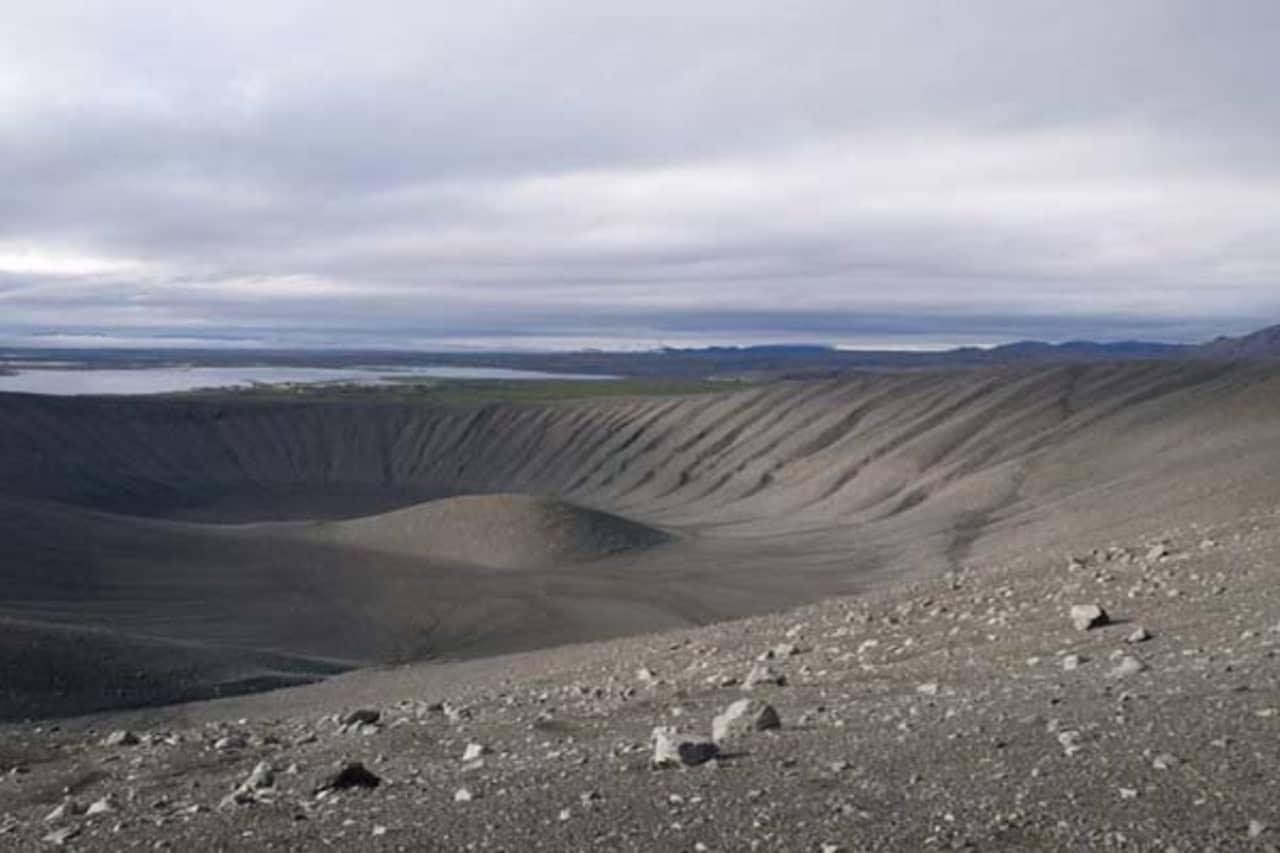
This is one of the most beautiful and shapely tephra cones in Iceland, believed to be one of the biggest ones in the world. It erupted around 2500 years ago and is quite special in that the bottom of the crater is almost as deep down as the rim is high. The lava got in touch with a large body of water, creating this tremendous amount of tephra. The locals do not agree on whether the mountain's name is Hverfjall or Hverfell, and so both are used in the title here. Mt. Hverfjall was protected as a natural site in 2011, to preserve the rare nature formations and also because of great educational and outdoor value. It is popular with hikers and the view on a clear day is amazing. From there you can see a lot of rifts, reminding us that this area is on the border between the North-American and the Eurasian plates, drifting apart around 2 centimetres annually. You can take the gravel road off the main road South of Vogar farm. The road is passable to most cars in summer but in winter it is often closed. The hike is not very difficult, but in winter ice and snow can cause problems so you are better off wearing cleats.
Accommodation nearby: Vogafjós Guesthouse - Guesthouse Eldá - Skútustaðir Farm Stay
ALDEYJARFOSS
- Location: Aldeyjarfoss
- GPS Coordinates: 65.3643260, -17.3415
- Region: North
- Duration: 0.5 hour
- Difficulty: Medium
- Distance: 1119m
- Height: 413m
- Increase: 38m

Photo Source: Visit North Iceland
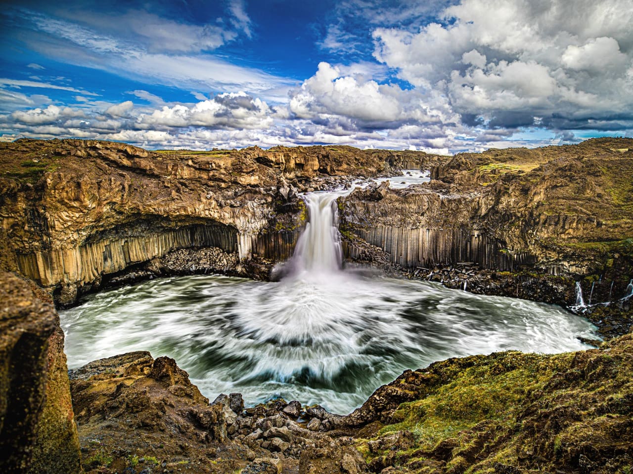
Aldeyjarfoss waterfall in Skálfandafljót river is one of the most beautiful waterfalls in Iceland despite its relatively low height of 20 meters. It is surrounded by black basalt columns providing a contrast against the thrashing white glacial river. The waterfall is situated in Bárðardalur valley which is the longest populated valley in Iceland and reaches a length of 45 km along the Skjálfandafljót River. Just 2 km from the waterfall is the farm Mýri and a bit firther South is the edge of the highlands with the deserted landscape of Sprengisandur. Aldeyjarfoss is one of the most impressive waterfalls on the Skálfandafljót River’s route from the Vatnajökull ice cap to Skjálfandi Bay. Ingvararfoss and Hrafnabjargafoss are two more waterfalls only 4-500 meters further up the river.
This is a short hike and suitable for most people. Please notice that in winter you might need to park further away and walk. That might add 4-5 km to the total distance.
Accommodation nearby: Kiðagil Guesthouse
To be well prepared, make sure to check out the Things to Know Before a Hiking Trip in Iceland, and Top 10 Things to Pack for a Hiking Trip !